
“The quality and coverage of B2B contact database are very impressive...”
Mark J.
Create an account and get access to all information about NV5 Geospatial Software
No Credit card required. Free Credit

No Credit card required. It’s fast, easy, and FREE! 🛠️
“The quality and coverage of B2B contact database are very impressive...”
Mark J.
“The quality and coverage of B2B contact database are very impressive...”
Mark J.
“The quality and coverage of B2B contact database are very impressive...”
Mark J.

+9
| C-Level 1 | VP - Level0 |
| Director4 | Manager19 |
| Others28 | |
| Structure | Email Format |
|---|---|
| <first>.<last>@ | John.Smith@harris.com |
| <f><last>@ |
|
| Pain Points | Locations | Technologies |
|---|---|---|
| Digital Transformation | Guide Post, England, United Kingdom | e, communication, continuous improvement |
| Testing | Guide Post, England, United Kingdom | e, communication, continuous improvement |
NV5 Geospatial Software is a part of NV5. We create software products that help professionals across industries access, analyze, and share all types of data and imagery. Understand the World Around You Today, remotely sensed data is used to make critical decisions, to make discoveries, and to better understand the world around us. Various types of data, from airborne and satellite imagery to non-optical data such as LiDAR and SAR, is growing exponentially in availability and usage. Whether used autonomously or fused together for a more complete picture of a geographic area, remote sensing data is moving professionals across industries...
Remote sensing,data visualization,data analysis,image processing,geospatial image analysis,gis,geospatial imagery,lidar feature analysis,image analysis,3d data analysis,geospatial analytics,sar,envi,and idl
Nv5 geospatial software operates in the Software development industry.
Nv5 geospatial software's revenue is $5.50m
Nv5 geospatial software has 51 - 200 employees.

Get Started with the Free Forever plan! No credit card needed. Enjoy up to 10,000 free email credits per month at no cost.

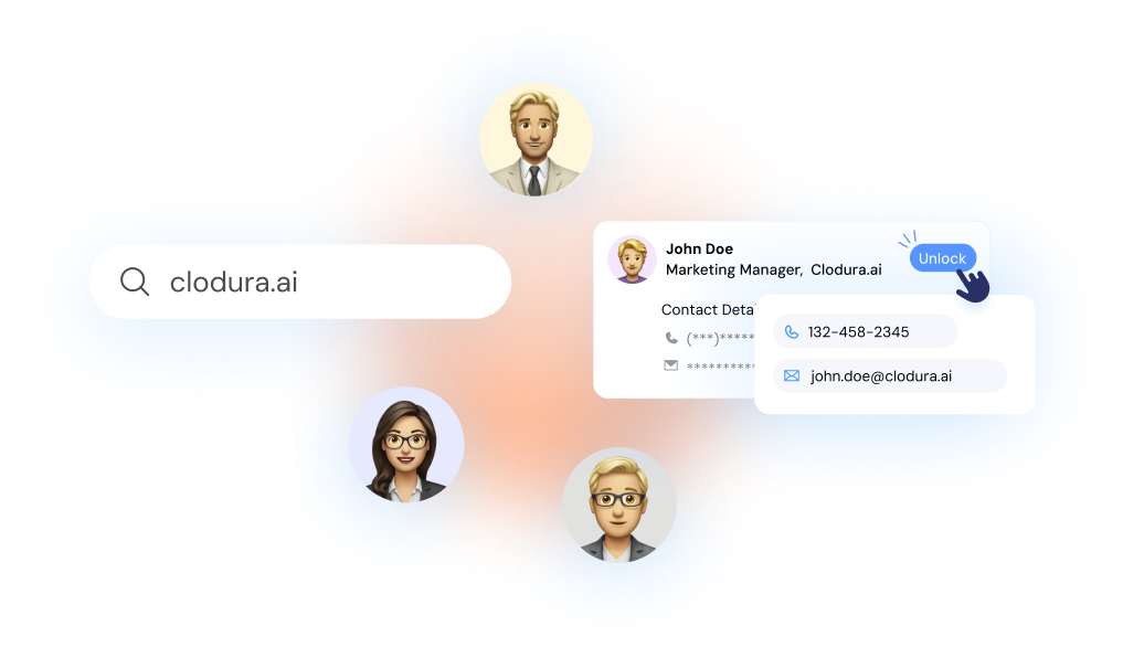
Start Prospecting from Clodura.AI's database of 600M+ verified B2B contacts and 120M+ direct dials along with 18M+ companies' org charts.

Unlock the prospect's contact details, including verified email, direct dials, add them to cadence, and close more deals.


